Planetary Intelligence
Powered by Deep Learning
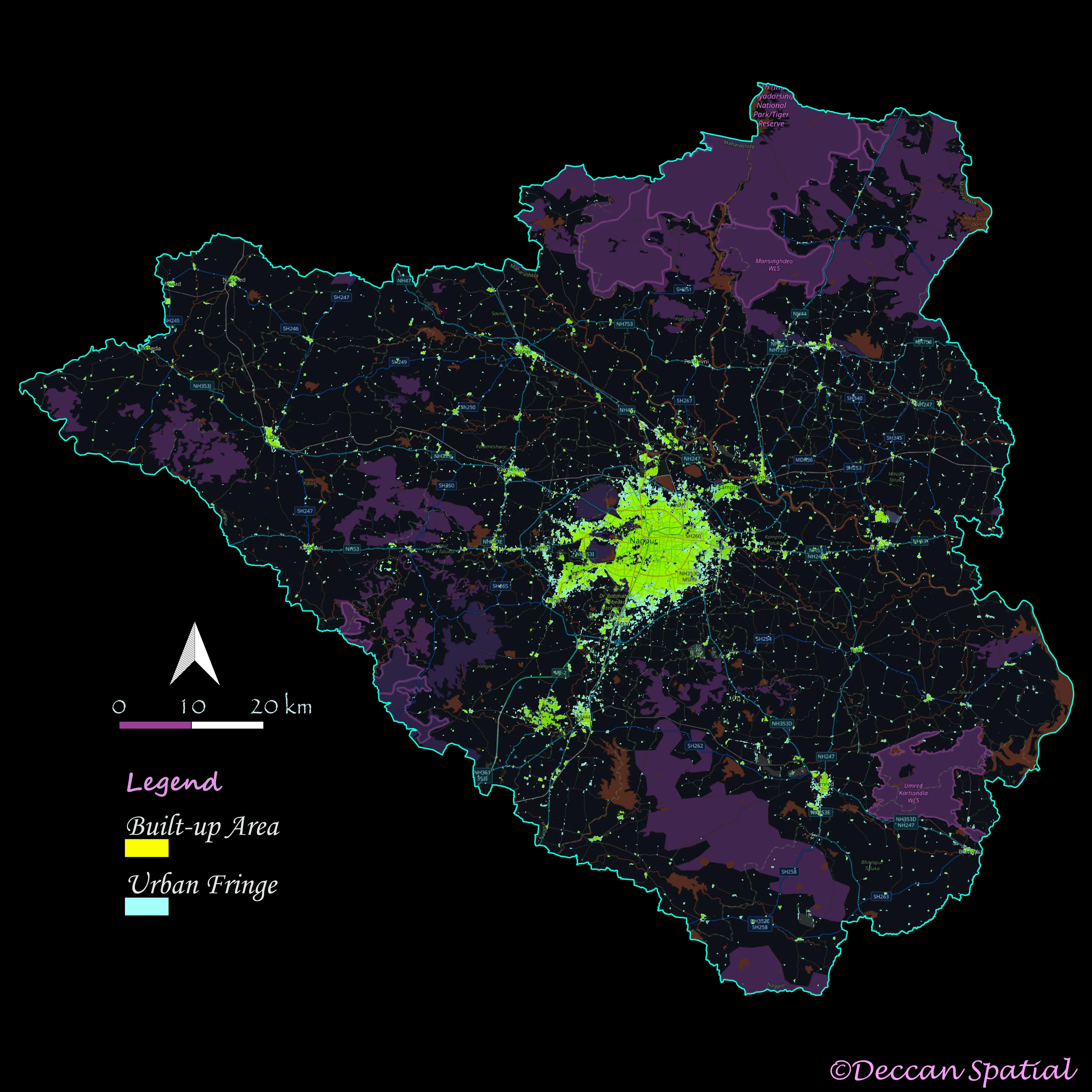
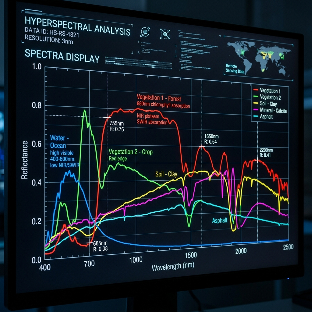
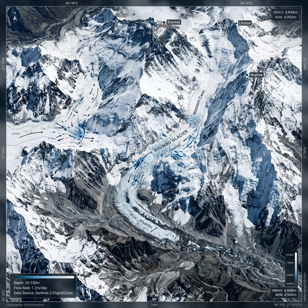
Extracting actionable insights from satellite imagery using advanced AI models. High-precision LULC, hyperspectral soil analysis, and automated climate mapping.
At Deccan Spatial, we are an Earth Observation startup building proprietary Deep Learning models. We specialize in processing petabytes of satellite data to generate high-resolution insights. From multi-temporal urbanisation monitoring to hyperspectral soil nutrient estimation, our pipelines turn noisy imagery into precise, pixel-level datasets at scale.
AI-driven land use classification utilizing temporal satellite imagery to track urban sprawl and fallow lands.
Advanced deep learning models for predicting soil nutrients using hyperspectral spectral signatures.
Advanced classification systems isolating commercial orchards from natural forest cover and tracking degradation.
Machine learning workflows for glacier mapping, terrain mapping unit delineation, and tracking climate correlations.
Projects Completed
Satellite Data Processed
AI/ML Pipelines Deployed
Years of Experience
Whether you need custom spatial analytics, capacity building, or consulting on your next big project, our team is ready to assist.
Click below to email us directly from your secure email client.
Email Us Securely